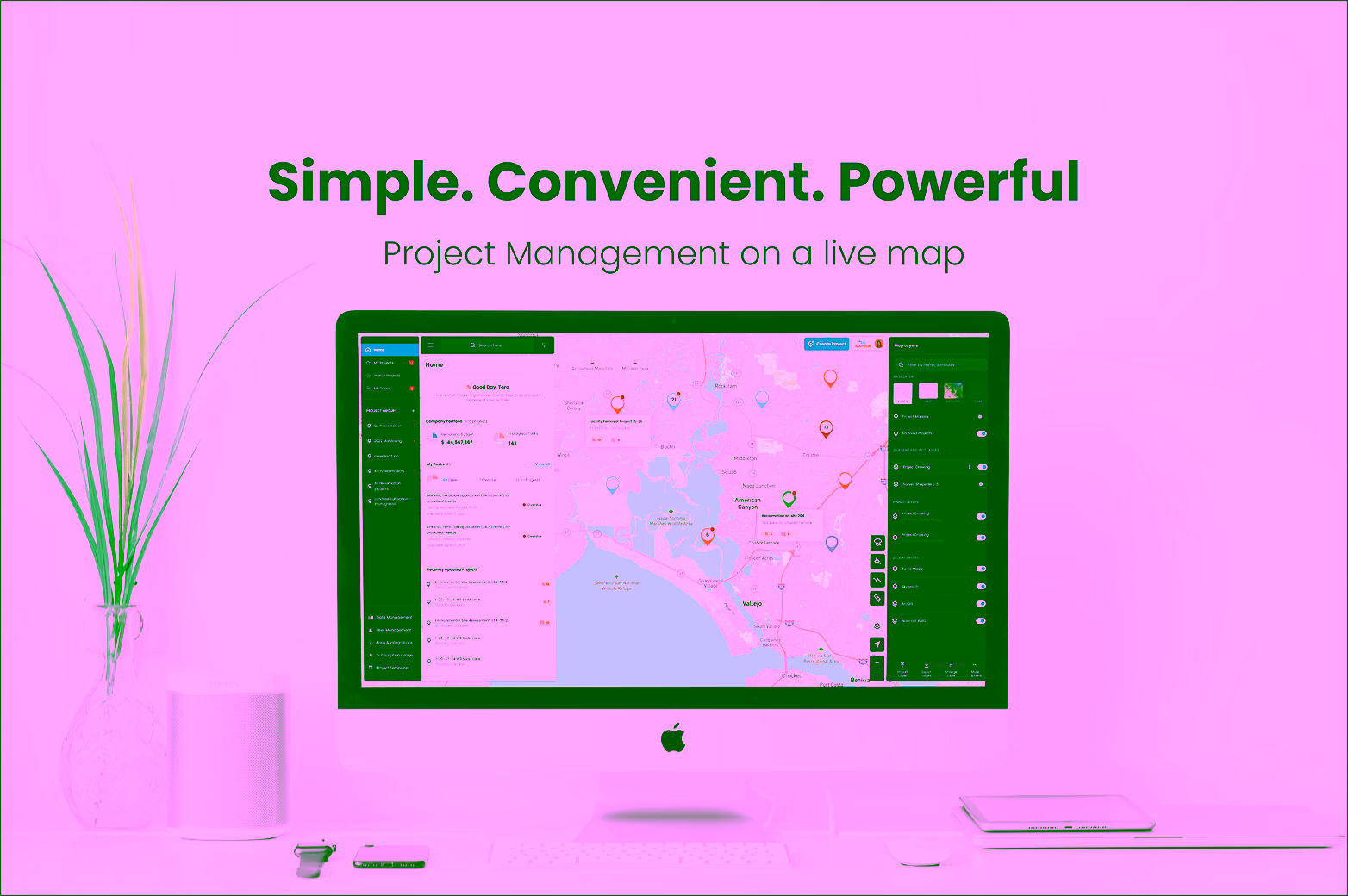
Matidor provides geospatial tools built for project management and team collaboration. It features powerful GIS integrations and visualization, streamlined team management, simplified financial management, and reporting.
Vancouver, BC, Canada
Founded in
2018

Company Overview

Matidor is a map-based project management and collaboration platform designed for field professionals. Global Field Services is a rapidly growing market and there is no easy way to keep track of the environmental impact, geospatial data, project costs and other operational and regulatory information that are critical for project managers and field workers. Matidor aims to become the ultimate location visualization and data collaboration tool that directly addresses the unique business needs in field services industries.

Thesis Fit

Matidor provides user-friendly project management tools leveraging geospatial data. Field operations cut across energy, mining, and environmental industries, which have historically relied on a patchwork of tools to coordinate across sites, partners, and budgets. Matidor specializes in U/X, data management, and collaboration while utilizing the best of the GEOINT tech stack to simplify cost management and to improve operating margin.