ICEYE: Decoding the Pulse of the Earth in Real Time
For decades, humanity has sought to continuously observe Earth without obstruction. While optical satellites have brought us closer, limitations like darkness, weather, and cost have kept the vision of an "all-seeing Earth" just out of reach. This blog post explores how Synthetic Aperture Radar (SAR) technology, particularly through the innovations of ICEYE, is finally making continuous, real-time Earth observation a reality, transforming fields from disaster response to defense and commercial systems.
The Myth of All-Seeing Earth
Since the first satellites began photographing the planet, humanity has chased a simple idea: to see Earth fully, continuously, and without obstruction. Each wave of innovation across decades brought us closer but never all the way, limited by the same constraints of night, weather, and cost. The idea of a truly all-seeing Earth has remained an aspiration more than reality, and became a shared pursuit carried forward through decades of spaceflight.
When people hear “Earth observation” (EO), most think of the vivid images that shape weather reports, digital maps, and intelligence briefings. These come from optical satellites, which are essentially cameras in orbit, capturing sunlight reflected from the surface. But because they depend on light, they also come with blind spots. Half the planet is in darkness at any given time. Clouds can obscure entire regions for days, while smoke and sand can erase whole landscapes from view. The higher the demand for continuous awareness in fields like agriculture, logistics, disaster response, or national security, the more those limits matter. We could photograph the world, but not continuously follow its movements as they unfold.
That difference between sensing and truly seeing defines the value of geospatial intelligence (GEOINT). Observation has always been a trade between clarity and continuity: optical sensors deliver exquisite detail, but as they blink, the flow of information collapses from real-time understanding into a series of disconnected frames. For defense and intelligence, that creates gaps in movement and intent. For insurers, it weakens precision, obscuring how conditions evolve. For infrastructure and logistics, it turns management into an exercise in assumption rather than evidence. The longer the gaps in observation, the less useful the previous image becomes. In a dynamic world, awareness is only as valuable as its timeliness.
That is why continuous visibility has long been the holy grail of EO systems. Optical constellations have dramatically shortened revisit times, with many now capturing most of the planet several times a day, but their reach still ends where light does, and atmospheric opacity remains an immovable limit. Thermal and hyperspectral systems add valuable spectral insight, and predictive models can estimate change between images, yet none can sustain truly unbroken awareness. Only radar has ever shown the potential to make observation truly continuous, rather than a sequence of moments.
Synthetic Aperture Radar, or SAR, was built on a radical idea: a satellite could actively send out its own radio signal and measure the echoes that return. The “synthetic” part refers to how the satellites’ motion replaces hardware. As it travels along its orbit, it sends many radar pulses toward the same area and then stitches those signals together to mimic what a much larger, stationary antenna would have seen. This technique turns faint echoes from the ground into sharp, detailed images, revealing structure, motion, and surface change in any conditions, day or night. In doing so, SAR offered the first real hope of becoming the foundation for an Earth that could finally be understood without interruption.
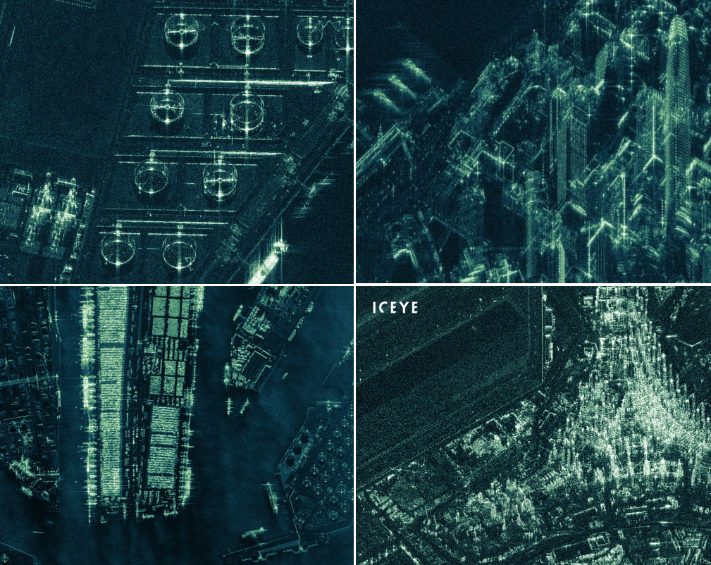
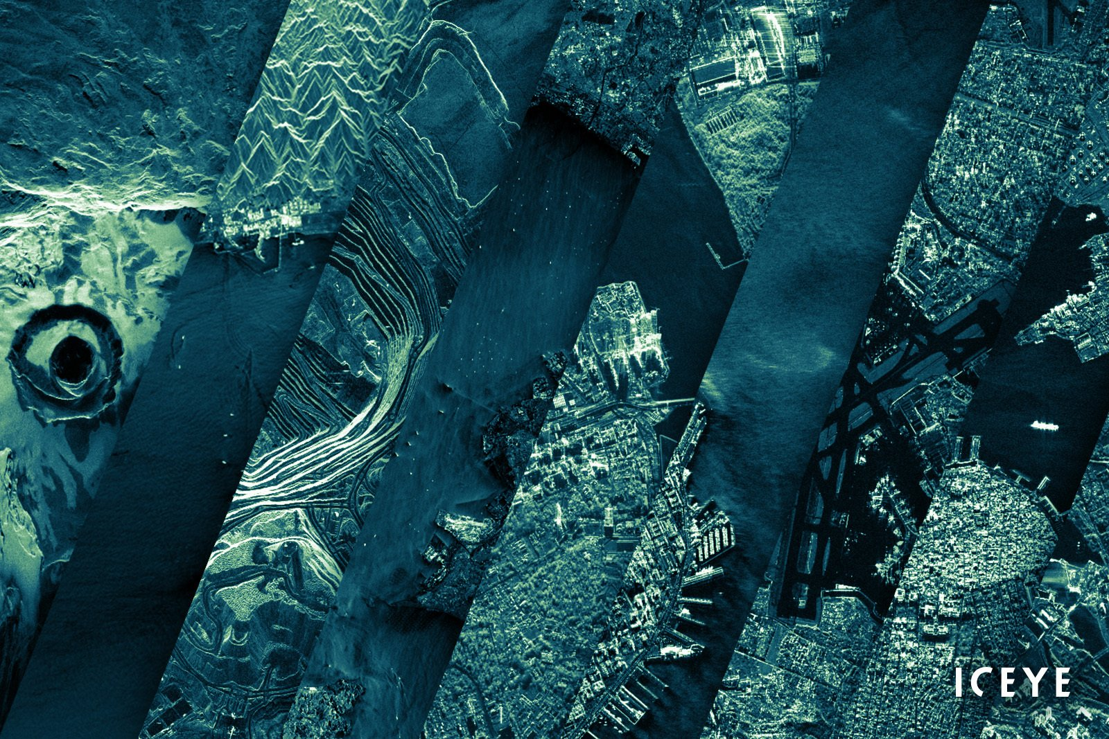
Figure. SAR images capture the geometric detail of modern infrastructure—from refineries and ports to dense urban grids—with remarkable clarity, revealing structure and activity beyond the limits of light and weather. (image source)
That vision remained out of reach for decades, as radar satellites existed only as large government programs as massive, power-hungry machines that cost hundreds of millions to launch and took days to process a single image. SAR was admired as a triumph of physics but dismissed as commercially impractical. The problem was structural: radar demands both strength and stability, with a long antenna to catch returning signals, high power to transmit them, and precise control to stay steady in orbit. Miniaturizing those systems broke the radar equation since shrinking the hardware meant losing sensitivity. Even if size could be reduced, transforming raw echoes into clear images required enormous computing power. The idea of placing radar on small, affordable satellites, the kind that had already revolutionized optical imaging, was considered futile by most and impossible by many.
The long-held belief that radar had to be large to be useful began to break, not in the corridors of major space agencies, but in a small university lab in Finland. At Aalto University, two young engineers with backgrounds in radio science and signal processing, Rafal Modrzewski and Pekka Laurila, approached radar design as an open problem rather than inherited doctrine. Frustrated by how little of Earth could be observed in time frames that mattered, they shared a goal to make geospatial awareness operate on human timescales, shortening the gap between observation and understanding. They recognized that persistent visibility was more than an engineering challenge, rather it was the economic foundation of GEOINT.
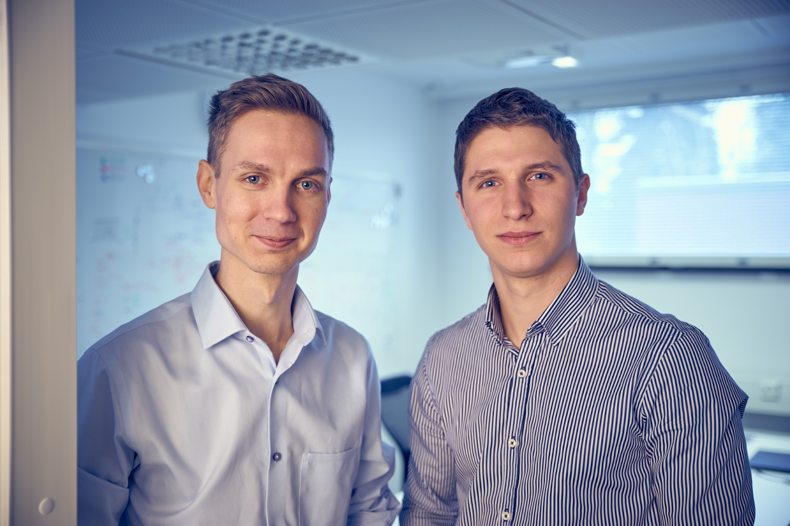
Figure. ICEYE Co-Founders Rafal Modrzewski (right) and Pekka Laurila (left), who met at Aalto University while pioneering small-satellite radar design. (image source)
Their starting point inspired the company’s name, ICEYE, drawn from its first mission to monitor shifting sea ice and iceberg movement from orbit. These are regions where cloud, darkness, and isolation often rendered optical imagery useless. If radar could track ice in the polar night, it could track almost anything. Yet the systems capable of that kind of continuity were still priced far beyond commercial reach. The founders understood that to make the radar approach truly viable, it had to be small enough to launch often and inexpensive enough to build in numbers.
SAR operates across several wavelength bands, each with distinct strengths. Long-wavelength systems such as the L-band, used in geological and forestry missions, can sense beneath vegetation and shallow ground. Mid-range C-band radars, like those on Europe’s Sentinel-1 satellites, balance penetration and surface clarity for regional monitoring. Higher-frequency X-band systems, widely used in precision weather and air-traffic radars, are tuned for sharpness and are highly sensitive to texture, movement, and fine surface change. Modrzewski and Laurila chose that X-band range because it offered the precision needed to capture rapid change from compact, affordable hardware.
They bet on advances in commercial off-the-shelf electronics, which had collapsed the cost and size of high-performance components, and on digital signal processing, which could replace physical scale with computation. What once required a two-ton spacecraft and a ten-meter antenna could, in principle, be achieved through efficient power management and short imaging cycles. In practice, every step introduced new engineering hurdles, from managing heat and vibration to calibrating stability and data quality. Their conviction that the world could finally be observed as it truly moves, revealing changes long understood but once impossible to capture, carried them through the barriers and quietly demystified the promise of an all-seeing Earth.
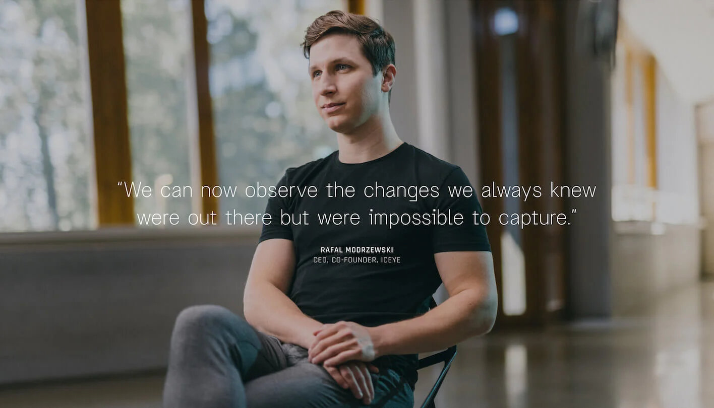
Figure. Rafal Modrzewski, ICEYE’s CEO and co-founder, reflecting on the company’s mission to make the unseen visible. (image source)
Engineering the Real-Time Earth
In the two years following its founding in 2014, ICEYE tested their first compact radar assemblies on small aircraft, refining each stage of signal control and data reconstruction. Those trials revealed what most large programs had missed: the fidelity of radar imagery depended less on size than on precision, which is how accurately each pulse could be transmitted, received, and aligned. If computation could replace mass, then radar could finally scale. Space Capital first engaged with the team during these early years that led to our initial investment in 2017, when we noticed the rare combination of a step change in technology and a bold commercial vision that would go on to redefine the world of EO.
Figure. Weighing only 70g, ICEYE-X1 is the world’s first SAR microsatellite and Finland’s first commercial satellite, marking the beginning of ICEYE’s operational constellation. (image source)
That conviction led to ICEYE-X1, launched in January 2018, and became the world’s first synthetic-aperture radar satellite under 100 kilograms, and the first proof that high-quality SAR imagery could be produced without a national-program infrastructure. Within days, X1 returned a coherent radar scene of Alaska’s Noatak Preserve, showing that calibration and coherence could be maintained from a suitcase-sized spacecraft. It was an extraordinary technical milestone, but not without hurdles.
The foundation that made ICEYE’s rapid progress possible lay in an architectural choice made early on: to standardize its entire constellation on the X-band. That decision shaped every satellite that followed, balancing high-resolution performance with manufacturability and cost. The shorter wavelength demanded exacting precision: smaller antennas magnified pointing errors, even minor drift or thermal variation could distort an image. What began as a design constraint became a long-term engineering discipline, forcing the team to master real-time calibration, control, and compensation at a level no commercial radar program had achieved before. Early missions revealed just how delicate that balance was. Localization drift, which are small discrepancies between orbital models and timing signals, sometimes produced several-meter offsets between radar pixels and their true ground positions. Each new satellite forced another cycle of instrument tuning, orbital modeling, and software correction simply to keep pixels where physics said they should be. But every iteration refined the system and deepened the team’s command over the subtleties of high-frequency radar.
Figure. ICEYE’s first radar image from space, captured on January 15, 2018 over Alaska’s Noatak National Preserve by the ICEYE-X1 microsatellite. (image source)
In the years following the inaugural launch, ICEYE advanced like a software company in orbit. Each generation built directly on the last, raising transmit power, refining pointing control, and accelerating downlink throughput. By 2019, the team delivered the first sub-meter radar imagery ever captured by a microsatellite, proving that miniaturization did not mean compromise. In 2020, ICEYE introduced SAR video, converting radar from static snapshots into motion sequences that could reveal surface change as it happened. On-board processing reduced data latency from days to hours, linking observation directly to action, but the path there was also far from linear. Progress came through years of wrestling with tight power budgets, thermal balance, and the immense computing demands of turning raw radar echoes into usable imagery on a small satellite.
As the spacecraft evolved, so did the infrastructure beneath them. ICEYE began building every critical layer in-house—radar electronics, spacecraft integration, ground stations, and cloud pipelines—to control both physics and economics. The company compressed satellite development cycles from years to months, a feat that introduced new production challenges: managing supply chains of commercial off-the-shelf components that were affordable but not always space-qualified. With repeated testing and tuning, ICEYE powered through those constraints, proving that innovation and affordability rarely coexist without tension, and that maturity in space systems is earned through hard trials as much as success.
At the same time, the software side of the constellation matured into its own advantage. ICEYE’s engineers built increasingly advanced digital simulators that modeled orbits and signal propagation before launch, allowing imaging modes to be tuned in code rather than hardware. Once in orbit, automated ground systems handled calibration, storage, and delivery with minimal human input. The company opened a public imagery archive and launched its Tasking API, letting users program satellite collections directly, turning what once required command-center coordination into a simple software request. Together, these layers of hardware, manufacturing, and code, made ICEYE a partner its customers trust to deliver.
Figure. A mosaic of ICEYE SAR imagery from the company’s Public Archive, showcasing diverse landscapes and contains nearly 18,000 images. (image source)
By 2025, ICEYE operated the world’s largest commercial SAR constellation, with more than fifty active satellites capable of imaging any point on Earth several times a day. Revisit intervals had narrowed to roughly an hour, enabling near-continuous tracking of change. Each satellite could shift between wide-area modes for regional coverage and high-resolution spotlight imaging with sub-meter precision, capturing details as fine as individual vehicles or infrastructure movements in any weather, day or night. True to its iterative approach, ICEYE continued to push the boundary of how fast intelligence could move through the system.
To bring its constellation closer to the edge, in September 2025 the company announced the ISR (Intelligence, Surveillance, and Reconnaissance) Cell—a self-contained, deployable ground unit that moves space intelligence from centralized infrastructure to the field. Housed in a containerized system, the ISR Cell gives defense and emergency teams direct access to satellite tasking, downlink, and AI-assisted analysis within minutes. Proven in NATO exercises, it compresses the traditional ISR cycle from hours to minutes, allowing commanders to collect, interpret, and act on radar intelligence without relying on distant ground stations.
Unlike aerial sensors, which are limited by range, weather, and electronic-warfare exposure, the ISR Cell connects directly to ICEYE’s constellation, maintaining global reach and resilience even in disrupted environments. It can operate with sovereign or ICEYE-owned satellites, serving as both a tactical node and a backup when fixed ground networks are compromised. The concept captures the company’s long-standing philosophy: merge sensor, network, and software into a single responsive instrument, turning space data into immediate operational awareness on the ground.
Figure. The ICEYE ISR Cell brings space intelligence to the edge, turning satellite tasking, data delivery, and AI analysis into a field operation, significantly compressing the traditional intelligence cycle. (image source)
In a decade of time, ICEYE transformed radar from a radar miniaturization experiment into a global, adaptive, distributed mission critical information system. The team’s quest for advanced physics became one of economics and execution, and each obstacle they met was answered through iteration, integration, and scale. We have since participated in multiple follow-on rounds, closely supporting ICEYE’s growth as it scaled from prototypes to an operational constellation with increasingly expansive capabilities, becoming the leading steward of the living infrastructure maintaining a real-time record of our dynamic Earth.
Persistent Awareness in Action
When ICEYE’s first radar satellites came online, the world already had an abundance of imagery but little continuity. Optical constellations could describe what had happened, not what was still happening. Yet the most urgent gaps were also the most consequential ones: floods rising faster than forecasts, wildfires advancing under cloud cover, storms cutting visibility for days. These were the moments when governments and insurers needed information most and had the least of it. SAR’s value began there, not as a replacement for optical imaging, but as the connective layer that preserved awareness when other systems reached their limits.
Civil Protection and Public Response
ICEYE’s earliest operational footholds formed in disaster monitoring. In 2022, the company began integrating near-real-time flood data directly into FEMA, NOAA, and European Civil Protection Mechanism platforms, turning radar imagery into a live operational feed for emergency management. This allowed response teams to track inundation through cloud and darkness, measuring depth, spread, and duration as events unfolded, and to plan proactively rather than reactively.
That same reliability drew scientific and institutional users. In 2023, ICEYE signed a multi-year Blanket Purchase Agreement with NASA to supply radar data for Earth science and hazard modeling, integrating commercial SAR into programs that monitor landslides, volcanic deformation, and polar ice dynamics. European hydrological networks soon adopted ICEYE’s data for near-real-time river-basin monitoring, extending its footprint into environmental infrastructure.
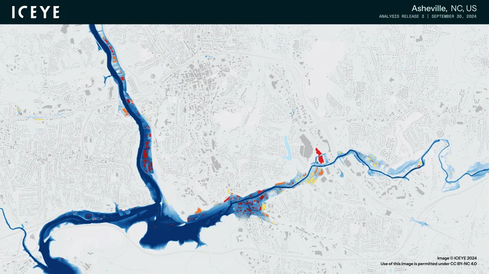
As revisit cadence increased, applications deepened. ICEYE’s ground-deformation measurements began supporting the structural health assessment of levees, dams, and transport corridors, detecting millimeter-scale shifts long before failure thresholds. The same technique now informs pipeline stability and urban subsidence monitoring, a capability under evaluation by several national infrastructure agencies. By 2025, ICEYE’s flood products were in active use during events such as Hurricane Helene, providing utilities and emergency agencies with sub-day analytics to guide power restoration and evacuation planning.
Figure. Flood extent and depth in Asheville, North Carolina, derived from ICEYE’s third flood analysis release following Hurricane Helene, providing critical insight for emergency response. (image source)
Defense and Intelligence
From disaster response, ICEYE’s capabilities naturally converged with defense, where continuity, rapid tasking, and weather independence are equally critical. In 2022, the company became the first commercial operator to grant sovereign tasking control of a radar satellite to a nation at war, leasing one spacecraft and constellation access to Ukraine’s Ministry of Defense. The system provided uninterrupted monitoring of cloud-covered fronts and supply corridors, establishing commercial radar as a core operational component of allied ISR rather than a peripheral source.
In 2023, the U.S. National Reconnaissance Office selected ICEYE under its Broad Agency Announcement (BAA) for Commercial Radar Capabilities to evaluate SAR data integration within national architectures. Shortly afterward, the U.S. Space Force awarded ICEYE and PAR Government a contract under the Proliferated LEO program to demonstrate distributed radar data fusion across multiple nodes. These partnerships marked a turning point: ICEYE was no longer just a service vendor but a trusted infrastructure partner embedded in Western ISR workflows.
By 2025, ICEYE’s role had expanded across NATO operations. A partnership with Rheinmetall, funded by the German Ministry of Defence, advanced dual-use radar satellites supporting Europe’s pursuit of ISR autonomy. NATO’s Situation Centre (SITCEN) and Allied Command Operations (ACO) incorporated ICEYE imagery into operational tasking, with average data delivery times falling below one hour. Sovereign procurements soon followed: Poland’s MicroSAR constellation and national ground segment valued near €200M; the Royal Netherlands Air Force’s four-satellite contract supported by an AI-enabled analysis cell; and the Portuguese Air Force’s regional surveillance program for the Atlantic.
Earlier this year ICEYE also signed a direct satellite acquisition agreement with the Finnish Defence Forces, making its first fully sovereign satellite sale and extending its model from data provision to turnkey hardware delivery. At the same time, production began on the ISR Cell, with the first systems scheduled for delivery in 2026 across NATO partners including Poland, Portugal, the Netherlands, and Finland.
Commercial and Financial Systems
As governments focused on security, the private sector sought continuity of financial stability amid physical volatility. Beginning in 2021, ICEYE partnered with Aon to integrate radar-based flood data into catastrophe-risk models, giving insurers a way to track events in near-real time rather than rely solely on post-disaster reporting. Within two years, that collaboration expanded into multi-hazard coverage, including wildfire and wind, delivered through ICEYE’s Flood Insights and Wildfire Insights platforms. These services provided insurers with dynamic loss modeling during unfolding events, meaningfully shortening claims cycles and improving capital allocation for reinsurers.
In 2023, ICEYE partnered with Neptune Flood and Arturo AI to automate property-level loss estimation, creating the first radar-to-claims workflow in the insurance industry. Follow-on integrations with Duck Creek Technologies, Carahsoft, and later MAPFRE RE extended those analytics into reinsurance and global claims operations. Beyond insurance, the same SAR-driven monitoring now supports port authorities, energy operators, and logistics networks, detecting ground deformation or asset damage that optical systems often miss under cloud or darkness.
As ICEYE’s radar data became woven into the daily operations of insurers, utilities, national security agencies, and public-safety networks, having a global, continuous visibility of physical risk has become the new standard for critical decision-making. The shift was unmistakable: persistent monitoring has transformed GEOINT from a post-event process into the foundation of real-time response, unlocking a new level of effectiveness with clarity that never existed before.
Leading the Next Phase of Planetary Intelligence
ICEYE’s first decade proved that radar could be made small, affordable, and persistent. The decade ahead will test how far that persistence can scale. The company now leads an industry shifting from the limits of miniaturization toward the challenges of power, endurance, and orchestration at planetary scale.
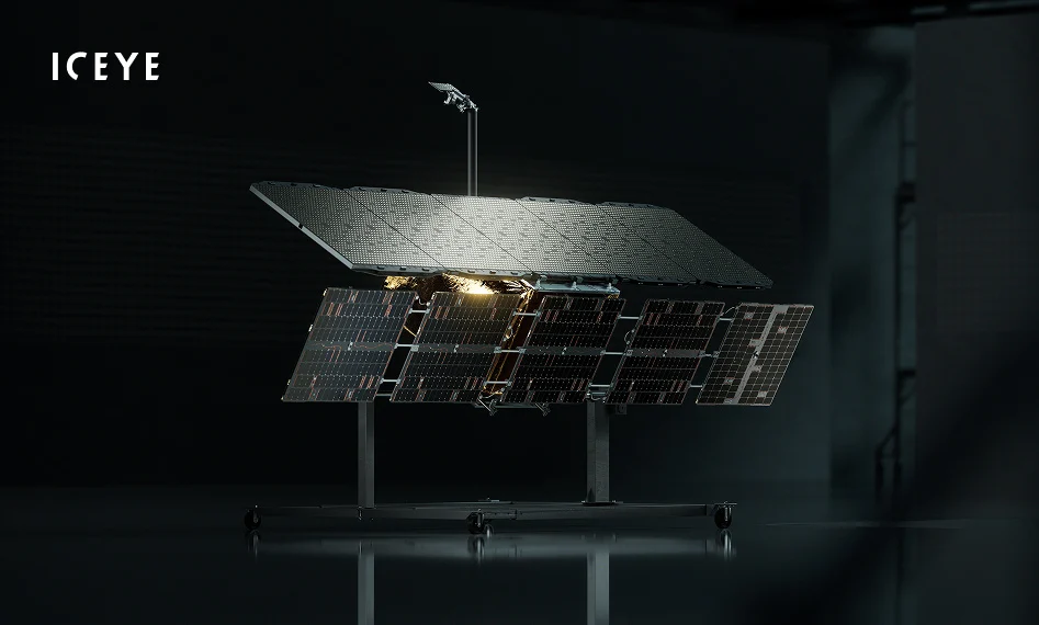
Figure. ICEYE’s Gen4 SAR satellites feature a doubled antenna and enhanced power system, representing the most advanced radar imaging platform ever built for wide-area, high-resolution Earth observation. (image source)
In March 2025, ICEYE introduced its fourth-generation radar satellites, known as Gen4, the most advanced commercial SAR system yet deployed. Each unit delivers imagery of up to 16-cm resolution, which is sharp enough to detect objects roughly the size of a soda can. It also expands high-resolution coverage from 150 to 400 kilometers per pass compared with the previous generation. That leap in field of regard enables wide-area monitoring at tactical resolution, allowing a single satellite to capture national-scale scenes such as entire floodplains, border zones, or maritime regions, in a single pass. Few commercial systems can match this balance of reach and precision, bridging the gap between strategic mapping and localized intelligence. A single satellite can now capture more than 500 images per day, with simultaneous imaging and downlink at 700 megabits per second. This combination takes near-real-time monitoring one step further, achieving sub-15-minute revisits over active regions. Larger antennas, more efficient amplifiers, and adaptive power management have turned what once required a national-class spacecraft into an industrial-grade system deployable by governments or enterprises within a year.
The next frontier for radar lies in power and endurance. SAR remains inherently energy-intensive: every transmission pulse draws high current and produces heat that must be dissipated without degrading precision. ICEYE’s microsatellites have solved cost and cadence but not yet the limitation of sustained duty cycles. Progress will depend on keeping radars active longer, recharging faster, and managing thermal loads more efficiently. Advances in semiconductor efficiency, battery chemistry, deployable solar arrays, and cooperative power sharing between satellites could extend imaging windows and reduce downtime. A constellation that distributes energy intelligently, where one satellite images while another relays or recharges, would operate as a living, self-managing sensor network in orbit.
A second horizon of innovation lies in the spectrum. Today, ICEYE’s fleet operates entirely in the X-band, optimized for high-resolution surface imaging. Next-generation systems may combine multiple frequencies to expand what radar can reveal. Dual-band SAR, pairing the precision of X-band with the deeper penetration of L-band, could enable simultaneous observation of surface and subsurface dynamics, such as tracking vehicles above canopy while mapping soil moisture or ground deformation below it. Such designs remain complex and power-hungry, but their ability to merge fine surface detail with volumetric depth could define the next leap in radar sensing capability.
As radar satellites stay active longer and sense across multiple frequency bands, they feed richer and more continuous streams of information into shared analytic systems. This evolution supports the rise of collective intelligence in orbit, enabling constellations that coordinate observations, cross-calibrate in real time, and respond dynamically to unfolding events. ICEYE’s current fleet already assigns tasking and downlink priorities across orbits, learning from each pass to refine coverage and timing. The result is a system that behaves less like a set of individual nodes and more like a single, adaptive instrument maintaining continuous awareness of Earth.
At the geopolitical level, persistent sensing has quietly joined energy, transport, and telecommunications as strategic infrastructure, as a capability nations now regard as essential to resilience and security. Governments no longer seek just access to imagery; they want sovereign control of the sensors that produce it. That shift toward national ownership is accelerating across the industry, exemplified by recent procurements such as Planet’s multi-year agreement with the German government for a sovereign EO service. ICEYE’s dual-use architecture, built for both commercial flexibility and sovereign deployment, places it at the center of this transition. Its recent partnerships with Poland, Finland, Portugal, and the Netherlands illustrate how radar constellations are becoming embedded within national industrial systems, standing alongside power grids and communications networks as critical infrastructure.
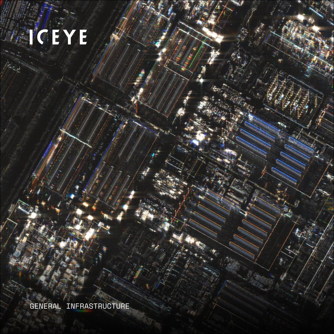
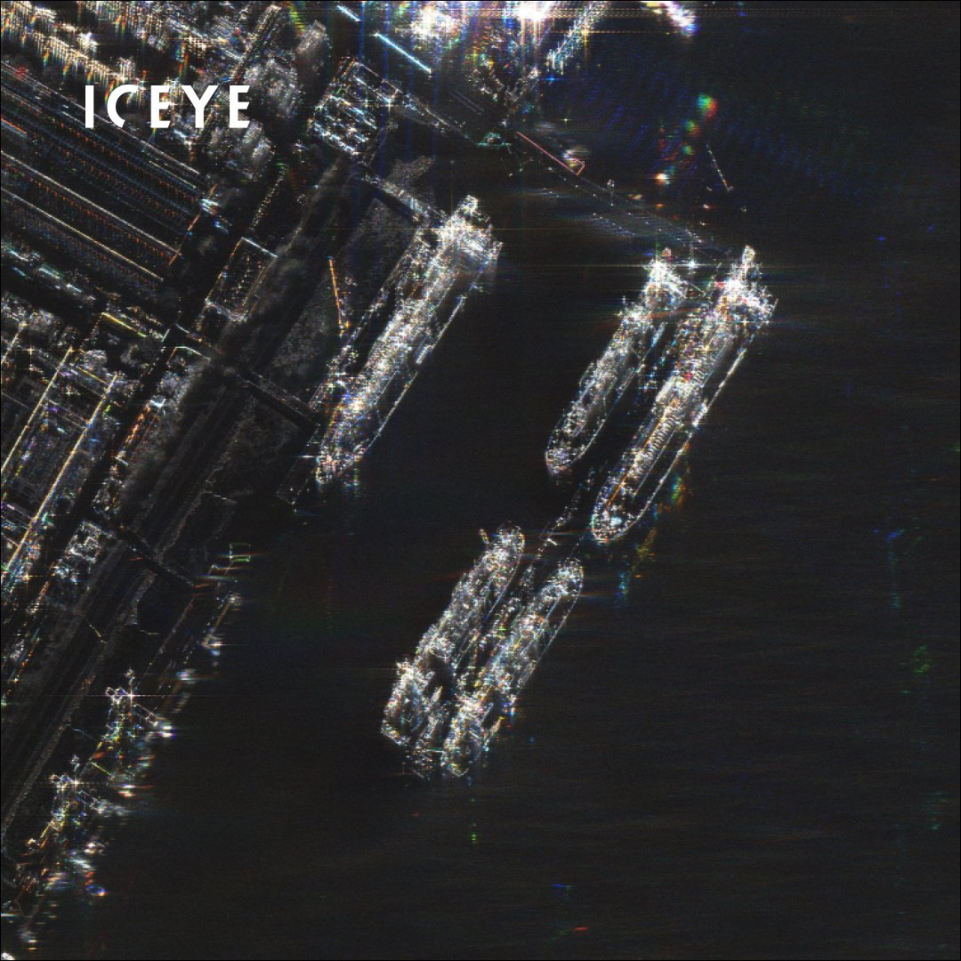
Figure. Docked ships and surrounding infrastructure are sharply defined in this colorized SAR image of Jiangnan Shipyard, China, captured by an ICEYE Gen4 satellite with a 16-cm resolution that marks a leap in commercial radar fidelity. (image source)
As British science fiction author Sir Arthur C. Clarke wrote in his Second Law, “The only way to discover the limits of the possible is to venture a little way past them into the impossible.” At Space Capital, we have followed ICEYE’s journey since its earliest prototypes, and it has been remarkable to watch a team of young engineers’ journey embodies that idea, pushing radar beyond what was once thought impossible to build a system that now defines the state of modern GEOINT. As the broader EO ecosystem fuses optical, radar, thermal, and hyperspectral sensing into unified systems, SAR remains the temporal backbone that decodes the pulse of our planet and anchors a new era of actionable understanding.
.avif)